Welcome to the Coastal Geotechnical Database
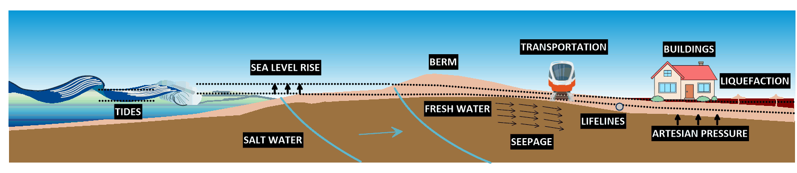
This database is an integral component of a broader project that is assessing impacts of sea level rise on soil liquefaction hazard in coastal areas of California. Sea level rise will cause groundwater levels to rise, thereby saturating soils currently above groundwater. Furthermore, artesian pressures may develop as we adapt to rising sea levels by pumping water from low-lying areas. These factors will increase liquefaction hazard, but the increase is currently not quantified. That is the purpose of this project. Significant infrastructure assets lie along coastal areas as depicted by the image below.
We are currently housed at University of California,
Los Angeles. This data was made available by the California Geological Survey
https://www.conservation.ca.gov/cgs.
The database contains geotechnical data from hospital and
school construction locations along the coast of California, up to 10 kilometers inland.
Available sites can be viewed on the map or in tabulated form under the Data drop-down menu. Each site may
include multiple boreholes. Tabulated borehole, stratigraphy, and soil sample information can be found
under the Data drop-down menu. Relevant soil stratum, groundwater information, and laboratory data from
the borelogs is included in the database.
This database will be used to analyze the influence of sea level rise on earthquake-induced soil
liquefaction hazards. Soil parameters and groundwater measurements will inform the development of a
groundwater model for the California Coast in order to quantify groundwater response to sea level rise
and water level fluctuations.Outputs from this model will be used to run a probabilistic liquefaction
hazard analysis. The UCERF3 (https://wgcep.org/UCERF3)
fault source model will be used, and exceedance
rates will be calculated at multiple return periods. The culmination of this project will be to create
a map of liquefaction severity considering sea level rise in coastal California.
Sponsors
The Coastal Geotechnical Database is sponsored by the UC Climate Action Initiative. click here for more info